
Mountain Fire survivors struggle with recovery #VenturaCounty #wildfires #MountainFire #Camarillo
https://www.kcra.com/article/mountain-fire-ventura-county-recovery-struggles/64526741
Recent searches
Search options

#camarillo
1 post1 participant0 posts today

Just dumped here. #Camarillo rain alert 0.29” at 1:15am

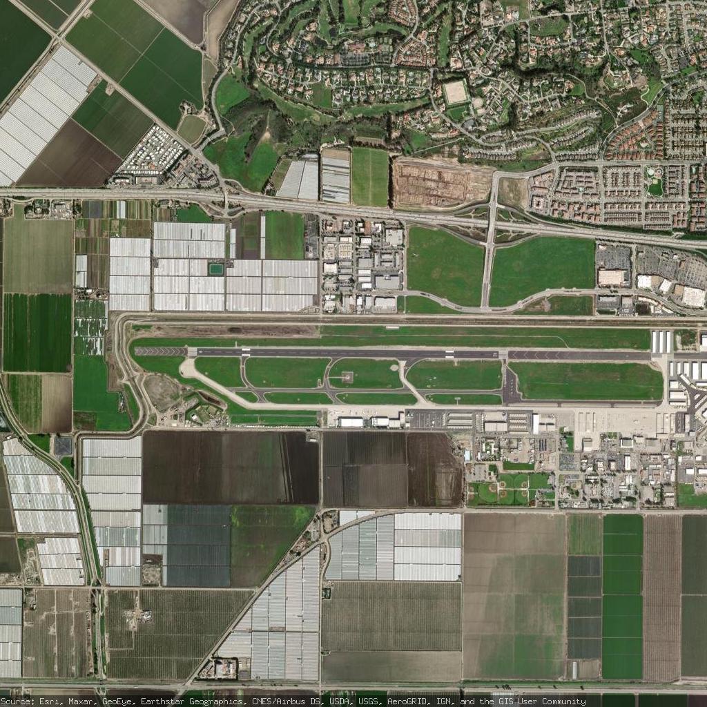
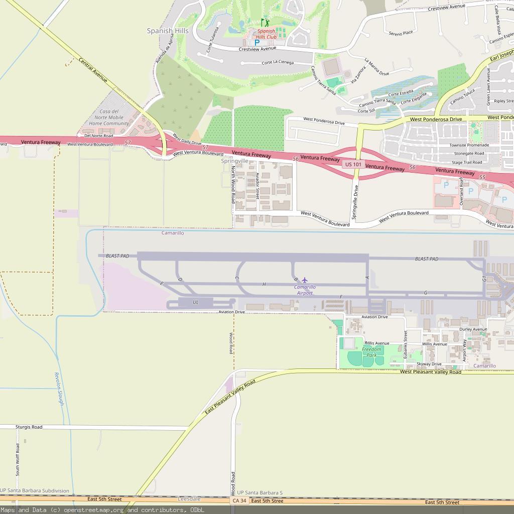
Camarillo International Airport - Camarillo, United States
https://en.wikipedia.org/wiki/Camarillo_Airport
https://www.openstreetmap.org/#map=13/34.213699/-119.094002
Continued thread
Was wondering what the news copter was doing.... #blackhelicopters #Camarillo #VenturaCounty

New copter of Camarillo is chasing mountain lions
"MOUNTAIN LION CAPTURED AFTER ROAMING CITY STREETS WEDNESDAY IN CAMARILLO:
A mountain lion was seen wandering city streets and residential areas early Tuesday afternoon in Camarillo.
The event caused a lot of activity from news copters, the Ventura County Sheriff's Department, and Animal Control. The lion appeared to be frequenting a residential area near the 101 Freeway and Lewis Road."

Mountain Fire Burn Area
An EVACUATION WARNING has been issued for residents near the Mountain Fire Burn Area effective Thursday February 13, 2025 from 10:00AM – Friday February 14, 2025 at 8:00AM.
Varying forecast models suggest a remote possibility peak rainfall rates near or above .75”/hr for some parts of the Mountain Fire Burn Area, including South Mountain....

Continued thread
MOUNTAIN FIRE BURN AREA
On the morning of February 12, 2025, the Evacuation Coordination Group for the Mountain Fire Burn Area met to assess the most current forecast. The team reached a consensus to send a Winter Weather Advisory via the VC Alert emergency notification system at approximately 2:00 PM this afternoon to an estimated 200 residents in the Mountain Fire Burn Area. For a map of locations included in the advisory areas, refer to the Real-time Incident Dashboard
https://vcoes.maps.arcgis.com/apps/dashboards/e15ca0d2737d43cea6514043e61f1a7c
(cont)
vcoes.maps.arcgis.comArcGIS DashboardsArcGIS Dashboards
Replied to AI6YR Ben

@ai6yr I'm sick as a dog right now. Definitely keep that mask on. #Camarillo #venturacounty #COVID19
Flood Advisory
National Weather Service Los Angeles/Oxnard CA
824 PM PST Sun Jan 26 2025
...FLOOD ADVISORY IN EFFECT UNTIL MIDNIGHT PST TONIGHT...
* WHAT...Flooding caused by excessive rainfall is expected.
* WHERE...East Ventura County from Camarillo through Simi Valley north to Topatopa Peak including the Mountain Burn Scar.

Flood Advisory
National Weather Service Los Angeles/Oxnard CA
342 PM PST Sun Jan 26 2025
...FLOOD ADVISORY IN EFFECT UNTIL 630 PM PST THIS EVENING...

Continued thread
Mountain Fire Rain Event - Town Hall
www.vcemergency.comMountain Fire Burn Area – VC Emergency
Ventura County
MOUNTAIN FIRE BURN AREA -RAIN EVENT
Ventura County Sheriff’s Emergency Services and the National Weather Service are monitoring a mild rain event expected to impact Ventura County Saturday through Monday. The current forecast calls for a significant cold front and rainfall totals between 0.1 – 0.50 inches. However, the cold air increases the chance of thunderstorms, which may potentially increase rainfall rates experienced in localized areas. Isolated intensities over recent burn areas may result in small, localized debris flows, but there is no current outlook that anticipates significant or large-scale debris flows or flooding.
Continued thread
FPS per IC. 1/23/25 1124 #Camarillo #LagunaFire #CSUCI #FireWx
Continued thread
They are asking the various divisions if okay to call Forward Progress Stopped (FPS). Not yet official. 1/23/25 1121 #Camarillo #LagunaFire #CSUCI #FireWx
Continued thread
(About to go walk the dog, so updates will be spotty for ~30 min). Live video of the fire is now streaming on multiple TV stations... KTLA here: https://ktla.com/news/california/wildfires/brush-fire-near-camarillo-spreading-rapidly-authorities-say/ 1/23/25 1033 #Camarillo #LagunaFire #CSUCI #FireWx
Continued thread
Edit: It's their fire investigator, LOL. 1/23/25 1024 #Camarillo #LagunaFire #CSUCI #FireWx
Continued thread
Fire is now 50 acres. 1/23/25 1023 #Camarillo #LagunaFire #CSUCI #FireWx
Continued thread
Parking Lot A CSUCI is now incident command (note to self: I guess I'm not parking there tonight LOL, class is cancelled) 1/23/25 1019 #Camarillo #LagunaFire #CSUCI #FireWx
Continued thread
Cancelling fixed wing, no more need for retardant. 1/23/25 1010 #Camarillo #LagunaFire #CSUCI #FireWx